Who We Are
Welcome to Dinwoody Geospacial & Services LLC, your premier provider of geospatial and drone services in Wyoming. We specialize in delivering cutting-edge solutions to businesses across a wide array of industries, ranging from agriculture to municipalities.
From precision agriculture and land surveying to infrastructure inspection and environmental monitoring, our team of experts is equipped with the knowledge and experience to tackle any project. By harnessing the power of drones and geospatial analysis, we provide actionable insights that drive informed decision-making and optimize business operations.
We understand that every project is unique, which is why we take a collaborative approach to ensure we exceed our client's expectations. Whether you're a small family farm or a large municipal corporation, we are committed to delivering exceptional results that drive success.
Contact us today to learn more about how we can elevate your business with our geospatial and drone services.
Our Services
-

Agricultural Monitoring
Using advanced drones and cutting-edge sensors, we specialize in precision agriculture services for farmers and ranchers. Our aerial imagery and data analytics optimize crop yields, conserve resources, and boost profitability.
-

Infrastructure Inspection
Our drone inspections assess infrastructure assets like roads, bridges, and utilities, identifying defects and enabling proactive maintenance, minimizing downtime and risks.
-

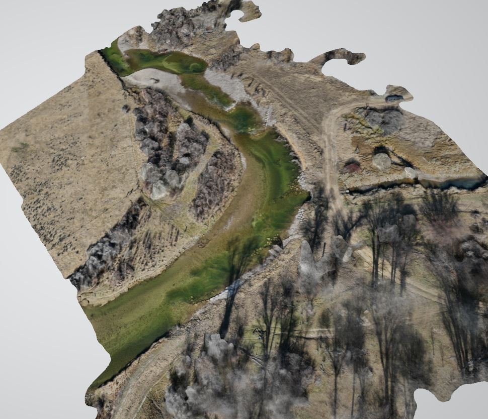
Environmental Monitoring
Our drone services assist environmental efforts with aerial surveys, habitat mapping, wildlife tracking, and vegetation analysis, aiding ecosystem management, biodiversity assessment, and habitat restoration.
-

Real Estate Marketing
We specialize in aerial photography and videography for real estate agencies, property developers, and homeowners. Our high-quality imagery enhances property marketing, attracts buyers, and facilitates virtual tours of residential and commercial properties.
-
GIS Mapping & Analysis
Utilizing our GIS expertise and drone technology, we provide mapping, surveying, and data visualization services. We support municipalities, government agencies, and private companies in land parcel mapping, monitoring land use changes, and spatial data analysis for informed decision-making.
-

Educational Programs
We offer educational workshops, training sessions, and STEM programs to schools, colleges, and universities interested in integrating drone technology into their curricula. Our programs cover drone piloting, aerial photography, data analysis, and applications across different fields of study.